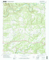
1973 Map of Cravens
USGS Topo · Published 1975About this map
The Mulberry River winds through the northern portion of this landscape, carving a valley beneath the dense canopy of the Ozark National Forest. In the early 1970s, the region was defined by its scattered settlements and extensive network of cemeteries, suggesting a long history of family homesteads in the Ozark foothills. Small communities like Jethro, Lone Elm, and Cravens serve as anchor points along rural roads, including the historical Wire Road that traverses the central terrain.
Find a feature on this map
39 named features on this map. Tap any name to fly to it.
Don’t see what you’re looking for? This feature index may not catch every label — zoom into the map to look around manually.
Map Details
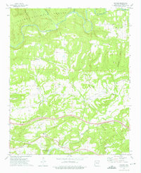
Editions of this 1973 Cravens Map
2 editions found
Other maps of this area

1879 · Cravens
USGS Topo · 1:62,500

1887 · Magazine Mountain #2
USGS Topo · 1:62,500

1887 · Watalula
USGS Topo · 1:62,500

1887 · Magazine Mountain
USGS Topo · 1:62,500

1890 · Magazine Mountain
USGS Topo · 1:125,000

1890 · Fort Smith
USGS Topo · 1:125,000

1898 · Winslow #4
USGS Topo · 1:62,500

1898 · Winslow
USGS Topo · 1:125,000

1901 · Winslow
USGS Topo · 1:125,000

1906 · Lavaca
USGS Topo · 1:62,500