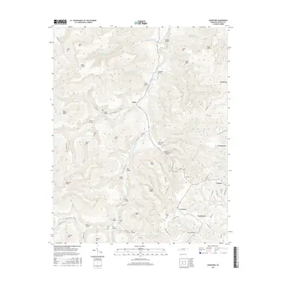
2016 Map of Crawford
USGS Topo · Published 2016About this map
The West Fork Obey River carves a deep path through this portion of Overton County, dictating the placement of early mountain settlements and family cemeteries. Small rural communities like Allred and Crawford are established along the valley floors and ridges, connected by winding routes such as Shiloh Rd and Cooktown Rd. The landscape is defined by its numerous named hollows and ridges, including Means Hollow, Daddy Ridge, and Hog Wallow Ridge, reflecting a long history of local land naming conventions.
Find a feature on this map
85 named features on this map. Tap any name to fly to it.
Don’t see what you’re looking for? This feature index may not catch every label — zoom into the map to look around manually.
Map Details
Editions of this 2016 Crawford Map
This is the sole edition of this map. No revisions or reprints were ever made.
Other maps of this area

1897 · Standingstone
USGS Topo · 1:125,000

1898 · Standingstone
USGS Topo · 1:125,000

1935 · Clarkrange
USGS Topo · 1:24,000

1943 · Cookeville
USGS Topo · 1:100,000

1944 · Cookeville
USGS Topo · 1:100,000

1944 · Livingston
USGS Topo · 1:24,000

1946 · Clarkrange
USGS Topo · 1:24,000

1946 · Obey City
USGS Topo · 1:24,000
1950 · Clarkrange
USGS Topo · 1:24,000
1950 · Obey City
USGS Topo · 1:24,000