
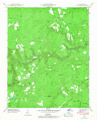
1946 Map of Clarkrange
USGS Topo · Published 1976About this map
The Cumberland Plateau is bisected here by the Alvin C York Highway, serving as a high-ground spine between the deep river gorges of the Obey River to the north and the expansive Catoosa Wildlife Management Area to the south. This 1946 survey, later updated with 1974 woodland recompilations, shows the rural development of Fentress County through its scattered schoolhouses and community churches, including Martha Washington School and Mt Union Ch. The topography is defined by a primary Divide that separates the northern drainages like Hurricane Creek from the southern headwaters of Clear Creek. Local history is embedded in place names like Steel Tram Ridge and The Horse Pound, while small settlements such as Muddy Pond, Looper, and Rinnie anchor the agricultural and timbered landscape between the major forks of the local river system.
Find a feature on this map
54 named features on this map. Tap any name to fly to it.
Don’t see what you’re looking for? This feature index may not catch every label — zoom into the map to look around manually.
Map Details
Editions of this 1946 Clarkrange Map
This is the sole edition of this map. No revisions or reprints were ever made.
Other maps of this area

1895 · Wartburg
USGS Topo · 1:125,000

1896 · Wartburg
USGS Topo · 1:125,000

1897 · Standingstone
USGS Topo · 1:125,000

1898 · Standingstone
USGS Topo · 1:125,000

1935 · Isoline
USGS Topo · 1:24,000

1935 · Campbell Junction
USGS Topo · 1:24,000

1935 · Clarkrange
USGS Topo · 1:24,000

1936 · Fox Creek
USGS Topo · 1:24,000

1936 · Jones Knob
USGS Topo · 1:24,000
1946 · Fox Creek
USGS Topo · 1:24,000