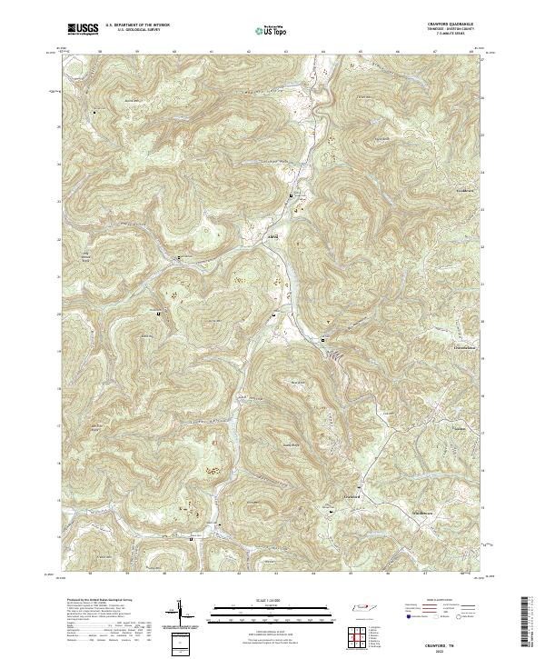
2022 Map of Crawford
USGS Topo · Published 2022About this map
Allred and Crawford are central hubs in this dissected region of Overton County, where the West Fork Obey River carves deep into the landscape near Daddy Ridge. This terrain is characterized by numerous hollows and knobs, which historically dictated the placement of settlements and family cemeteries. Genealogy researchers can find several burial grounds including Allred Cem, Shiloh Cem, and Speck Cem. The road network, though modern, follows traditional paths through locations like Happy Hollow and Gam Hollow, while the surrounding heights of Alpine Mtn and Egypt Knob illustrate the steep relief that has long defined life in this part of the Upper Cumberland. Small communities like Twinton and Windletown sit tucked away, preserving the 20th-century rural Tennessee settlement pattern where homes and small farms are clustered along mountain ridges and creek bottoms.
Find a feature on this map
91 named features on this map. Tap any name to fly to it.
Don’t see what you’re looking for? This feature index may not catch every label — zoom into the map to look around manually.
Map Details
Editions of this 2022 Crawford Map
This is the sole edition of this map. No revisions or reprints were ever made.
Other maps of this area

1897 · Standingstone
USGS Topo · 1:125,000

1898 · Standingstone
USGS Topo · 1:125,000

1935 · Clarkrange
USGS Topo · 1:24,000

1943 · Cookeville
USGS Topo · 1:100,000

1944 · Cookeville
USGS Topo · 1:100,000

1944 · Livingston
USGS Topo · 1:24,000

1946 · Clarkrange
USGS Topo · 1:24,000

1946 · Obey City
USGS Topo · 1:24,000
1950 · Clarkrange
USGS Topo · 1:24,000
1950 · Obey City
USGS Topo · 1:24,000