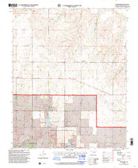
1998 Map of Crawford
USGS Topo · Published 2001About this map
Black Kettle National Grassland dominates the southern landscape of this Roger Mills County region, reflecting the conservation and land management efforts of the late 20th century. This area is defined by its drainage systems, where the Washita River winds through the south while numerous creeks like Dugout Creek, Bull Creek, and Dead Indian Creek carve the upland prairie. The small community of Crawford serves as a local hub, with the nearby United Pentecostal Ch and Sunrise Cem providing vital points of reference for genealogists and local historians. Outdoor recreation is centered around Spring Creek Lake and the Spring Creek Campground, highlighting the shift toward public land use in this western Oklahoma territory. The presence of an Oil Well and various pipelines indicates the local reliance on energy extraction alongside traditional ranching.
Find a feature on this map
18 named features on this map. Tap any name to fly to it.
Don’t see what you’re looking for? This feature index may not catch every label — zoom into the map to look around manually.
Map Details
Editions of this 1998 Crawford Map
This is the sole edition of this map. No revisions or reprints were ever made.
Other maps of this area

1955 · Clinton
USGS Topo · 1:250,000

1957 · Clinton
USGS Topo · 1:250,000

1960 · Cheyenne
USGS Topo · 1:62,500

1961 · Reydon
USGS Topo · 1:62,500

1965 · Roll NW
USGS Topo · 1:24,000

1965 · Crawford
USGS Topo · 1:24,000

1966 · Roll
USGS Topo · 1:24,000

1966 · Antelope Hills NE
USGS Topo · 1:24,000

1966 · Antelope Hills
USGS Topo · 1:24,000

1966 · Durham
USGS Topo · 1:24,000