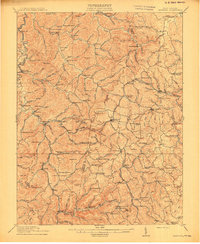
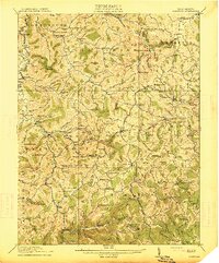
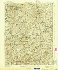
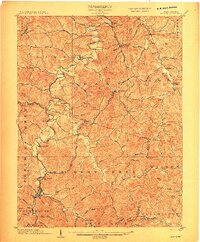
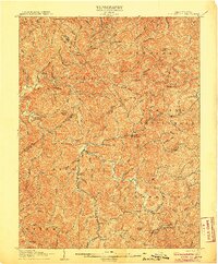
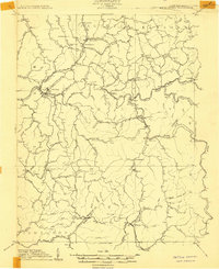
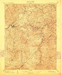
1914 Map of Crawford
USGS Topo · Published 1914About this map
The Little Kanawha River and the West Fork River headwaters define this 1914 landscape, carving through the high ridges of Lewis and Upshur Counties. The Baltimore and Ohio RR cuts through the northern terrain, serving rural hubs like Roanville Sta and Jacksonville. This map documents a dense network of early 20th-century rural infrastructure, specifically highlighting a high concentration of local school districts, including the Handkerchief Union School, Radabaugh School, and Sugarcamp School. Small-scale industrial life is visible at Alkires Mills, while the numerous knobs—such as Wilson Knob and Bee Knob—illustrate the complex topography of the Allegheny Plateau before modern development. Genealogists will find interest in the distinct settlements of Frenchton, Walkersville, and Hinkleville during a period of peak rural population.
Find a feature on this map
134 named features on this map. Tap any name to fly to it.
Don’t see what you’re looking for? This feature index may not catch every label — zoom into the map to look around manually.
Map Details
Editions of this 1914 Crawford Map
3 editions found
Other maps of this area

1893 · Buckhannon
USGS Topo · 1:125,000

1893 · Sutton
USGS Topo · 1:125,000

1896 · Buckhannon
USGS Topo · 1:125,000

1897 · Buckhannon
USGS Topo · 1:125,000

1904 · Philippi
USGS Topo · 1:62,500
1904 · Weston
USGS Topo · 1:62,500

1904 · Vadis
USGS Topo · 1:62,500
1906 · Burnsville
USGS Topo · 1:62,500
1908 · Sutton
USGS Topo · 1:48,000
1910 · Sutton Special
USGS Topo · 1:62,500