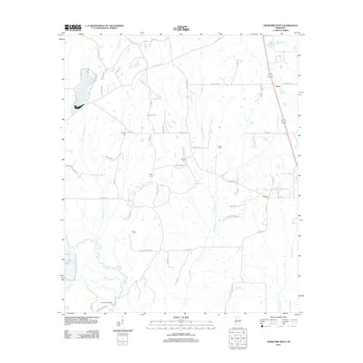
2012 Map of Crawford West
USGS Topo · Published 2012About this map
The Noxubee River winds through the southern reaches of this landscape, its path joined by Lookfoma Cr and bridged at Edmonds Bridge. To the north, the small settlement of Penns sits along the rail corridor, surrounded by a network of rural roads that connect family names to the land. This 2012 survey illustrates a quiet, agricultural region defined by its creek systems, including the long course of Shotbag Cr and the waters of Browning Cr.
Find a feature on this map
63 named features on this map. Tap any name to fly to it.
Don’t see what you’re looking for? This feature index may not catch every label — zoom into the map to look around manually.
Map Details
Editions of this 2012 Crawford West Map
This is the sole edition of this map. No revisions or reprints were ever made.
Other maps of this area

1953 · West Point
USGS Topo · 1:250,000

1958 · West Point
USGS Topo · 1:250,000

1959 · Artesia
USGS Topo · 1:62,500

1963 · West Point
USGS Topo · 1:250,000

1965 · Starkville
USGS Topo · 1:24,000

1965 · Bluff Lake
USGS Topo · 1:24,000
1973 · Brooksville
USGS Topo · 1:24,000
1973 · Barge Lake
USGS Topo · 1:24,000
1973 · Lynn Creek
USGS Topo · 1:24,000

1984 · West Point
USGS Topo · 1:250,000