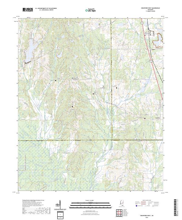
2024 Map of Crawford West
USGS Topo · Published 2024About this map
Crawford and Penns anchor the landscape of this eastern Mississippi region, situated at the crossroads of Oktibbeha, Lowndes, and Noxubee counties. The southern reaches are defined by the conservation lands of the Sam D Hamilton Noxubee National Wildlife Refuge, where the Noxubee River and Oktoc Creek wind through timbered wetlands. This area reveals a dense history of congregational life and rural burial grounds, including the Brown Ridge Missionary Baptist Church in the northeast and Bethesda Baptist Church further west. Local genealogy is well-represented through family-named landmarks like Sanders Cem and Crigler Cem. The topography is marked by significant water features such as Rocky Bottom Creek and the Green Timber Reservoir Number Two, illustrating the importance of water management and wildlife preservation in the modern era.
Find a feature on this map
74 named features on this map. Tap any name to fly to it.
Don’t see what you’re looking for? This feature index may not catch every label — zoom into the map to look around manually.
Map Details
Editions of this 2024 Crawford West Map
This is the sole edition of this map. No revisions or reprints were ever made.
Other maps of this area

1953 · West Point
USGS Topo · 1:250,000

1958 · West Point
USGS Topo · 1:250,000

1959 · Artesia
USGS Topo · 1:62,500

1963 · West Point
USGS Topo · 1:250,000

1965 · Starkville
USGS Topo · 1:24,000

1965 · Bluff Lake
USGS Topo · 1:24,000
1973 · Brooksville
USGS Topo · 1:24,000
1973 · Barge Lake
USGS Topo · 1:24,000
1973 · Lynn Creek
USGS Topo · 1:24,000

1984 · West Point
USGS Topo · 1:250,000