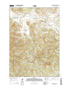
2014 Map of Crawfordsville
USGS Topo · Published 2014About this map
The Calapooia River meanders through this portion of Linn County, anchoring the small settlements of Crawfordsville and Holley along its banks. The terrain transitions from the river valley into significant elevations such as Scott Mountain and Georges Knob, while the southern reaches of the map touch upon the headwaters of the Mohawk River. Local infrastructure is defined by its historic crossings, specifically the Crawfordsville Bridge and Matlock Bridge, which facilitate travel along the corridor of Or-228.
Find a feature on this map
54 named features on this map. Tap any name to fly to it.
Don’t see what you’re looking for? This feature index may not catch every label — zoom into the map to look around manually.
Map Details
Editions of this 2014 Crawfordsville Map
This is the sole edition of this map. No revisions or reprints were ever made.
Other maps of this area

1911 · Brownsville
USGS Topo · 1:31,680

1921 · Brownsville
USGS Topo · 1:62,500

1950 · Marcola
USGS Topo · 1:62,500

1950 · Brownsville
USGS Topo · 1:62,500

1951 · Sweet Home
USGS Topo · 1:62,500

1951 · Leaburg
USGS Topo · 1:62,500

1952 · Brownsville
USGS Topo · 1:62,500

1952 · Marcola
USGS Topo · 1:62,500

1953 · Salem
USGS Topo · 1:250,000

1954 · Salem
USGS Topo · 1:250,000