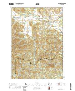
2020 Map of Crawfordsville
USGS Topo · Published 2020About this map
The Calapooia River meanders through a valley of timber and agriculture, anchoring the small settlements of Crawfordsville and Holley in this 2020 USGS survey of Linn County. This corner of Oregon is defined by its transition from the river valley into the southern foothills, where Crescent Hill and Grassy Mtn rise above a dense network of forest roads and creeks. Local history is anchored by the Independent Order of Odd Fellows Cem and the Crawfordsville Union Cem, while the Crawfordsville Bridge and Matlock Bridge mark critical crossing points over the Calapooia. The map also captures the headwaters of the Mohawk River system to the south, near the Linn Co Lane Co boundary. Researchers will find a landscape that maintains its rural character, where naming conventions like McQueen Dr and Courtney Creek Dr hint at the legacy of early landholding families.
Find a feature on this map
52 named features on this map. Tap any name to fly to it.
Don’t see what you’re looking for? This feature index may not catch every label — zoom into the map to look around manually.
Map Details
Editions of this 2020 Crawfordsville Map
This is the sole edition of this map. No revisions or reprints were ever made.
Other maps of this area

1911 · Brownsville
USGS Topo · 1:31,680

1921 · Brownsville
USGS Topo · 1:62,500

1950 · Marcola
USGS Topo · 1:62,500

1950 · Brownsville
USGS Topo · 1:62,500

1951 · Sweet Home
USGS Topo · 1:62,500

1951 · Leaburg
USGS Topo · 1:62,500

1952 · Brownsville
USGS Topo · 1:62,500

1952 · Marcola
USGS Topo · 1:62,500

1953 · Salem
USGS Topo · 1:250,000

1954 · Salem
USGS Topo · 1:250,000