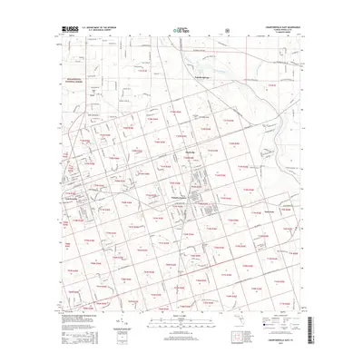
2015 Map of Crawfordville East
USGS Topo · Published 2015About this map
Wakulla Springs and the headwaters of the Wakulla River dominate this portion of the Florida Panhandle, where the aquifer surfaces in a complex network of springs and sloughs. This 2015 study captures the modern landscape of Wakulla County, documenting the expansion of residential communities like Shadeville, Wakulla Gardens, and Hyde Park amidst the dense woodlands of the Apalachicola National Forest.
Find a feature on this map
275 named features on this map. Tap any name to fly to it.
Don’t see what you’re looking for? This feature index may not catch every label — zoom into the map to look around manually.
Map Details
Editions of this 2015 Crawfordville East Map
This is the sole edition of this map. No revisions or reprints were ever made.
Other maps of this area

1940 · Tallahassee
USGS Topo · 1:62,500

1940 · Arran
USGS Topo · 1:62,500

1942 · Tallahassee
USGS Topo · 1:62,500

1943 · Arran
USGS Topo · 1:62,500

1943 · Tallahassee
USGS Topo · 1:62,500

1954 · Sprague Island
USGS Topo · 1:24,000

1954 · Woodville
USGS Topo · 1:24,000

1954 · St. Marks
USGS Topo · 1:24,000

1954 · Tallahassee
USGS Topo · 1:250,000

1959 · Tallahassee
USGS Topo · 1:250,000