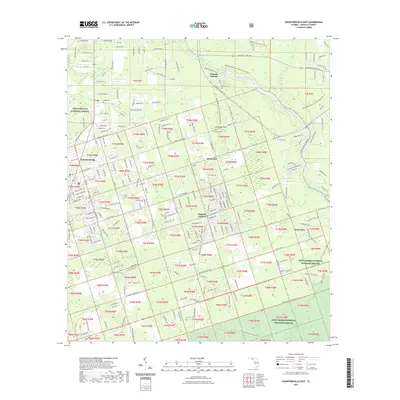
2021 Map of Crawfordville East
USGS Topo · Published 2021About this map
Wakulla Springs and the headwaters of the Wakulla River anchor the northern landscape of this Wakulla County region. The terrain is defined by the transition between the sprawling Apalachicola National Forest to the west and the marshy expanses of the Saint Marks National Wildlife Refuge to the southeast. For genealogists, the map preserves the location of family-named burial grounds like Duggar Cem, Causseaux Cem, and Raher Cem, alongside established communities such as Shadeville and Wakulla Gardens. Local landmarks such as Cherokee Sink and My Bridge Slough reveal the area's intricate hydrology. The southern portion of the survey is notably divided into numerous township and range sections, reflecting the modern residential development and property partitioning surrounding the historic settlement of Crawfordville.
Find a feature on this map
296 named features on this map. Tap any name to fly to it.
Don’t see what you’re looking for? This feature index may not catch every label — zoom into the map to look around manually.
Map Details
Editions of this 2021 Crawfordville East Map
This is the sole edition of this map. No revisions or reprints were ever made.
Other maps of this area

1940 · Tallahassee
USGS Topo · 1:62,500

1940 · Arran
USGS Topo · 1:62,500

1942 · Tallahassee
USGS Topo · 1:62,500

1943 · Arran
USGS Topo · 1:62,500

1943 · Tallahassee
USGS Topo · 1:62,500

1954 · Sprague Island
USGS Topo · 1:24,000

1954 · Woodville
USGS Topo · 1:24,000

1954 · St. Marks
USGS Topo · 1:24,000

1954 · Tallahassee
USGS Topo · 1:250,000

1959 · Tallahassee
USGS Topo · 1:250,000