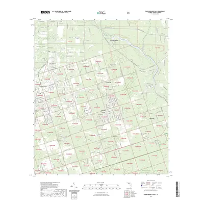
2023 Map of Crawfordville East
USGS Topo · Published 2023About this map
Wakulla Springs and the headwaters of the Wakulla River anchor this 2023 landscape, where the Edward Ball Wakulla Springs State Park Trail and Wakulla State Forest Trl meet the extensive wetlands of the Panhandle. The map reveals a transition from the public lands of the Apalachicola National Forest in the west to the protected marshes of the Saint Marks National Wildlife Refuge in the southeast. Cultural history is preserved in several family burial grounds, including Duggar Cem, Gausseaux Cem, and Raher Cem, scattered near the communities of Shadeville and Hyde Park. The local seat of government at the Wakulla County Courthouse in Crawfordville serves as the western boundary for a region defined by its diverse ecosystem and the long path of the Florida National Scenic Trail.
Find a feature on this map
101 named features on this map. Tap any name to fly to it.
Don’t see what you’re looking for? This feature index may not catch every label — zoom into the map to look around manually.
Map Details
Editions of this 2023 Crawfordville East Map
This is the sole edition of this map. No revisions or reprints were ever made.
Other maps of this area

1940 · Tallahassee
USGS Topo · 1:62,500

1940 · Arran
USGS Topo · 1:62,500

1942 · Tallahassee
USGS Topo · 1:62,500

1943 · Arran
USGS Topo · 1:62,500

1943 · Tallahassee
USGS Topo · 1:62,500

1954 · Sprague Island
USGS Topo · 1:24,000

1954 · Woodville
USGS Topo · 1:24,000

1954 · St. Marks
USGS Topo · 1:24,000

1954 · Tallahassee
USGS Topo · 1:250,000

1959 · Tallahassee
USGS Topo · 1:250,000