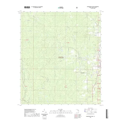
2021 Map of Crawfordville West
USGS Topo · Published 2021About this map
Apalachicola National Forest dominates this section of the Florida Panhandle, where the landscape is defined by vast wetlands and complex drainage systems. These features, including Mosquito Bay, Cow Swamp, and Bradwell Bay, reflect the low-lying hydrology typical of Wakulla County. The drainage network is anchored by the Sopchoppy River and Lost Creek, which weave through the forest alongside numerous ponds like Cypress Pond.
Find a feature on this map
86 named features on this map. Tap any name to fly to it.
Don’t see what you’re looking for? This feature index may not catch every label — zoom into the map to look around manually.
Map Details
Editions of this 2021 Crawfordville West Map
This is the sole edition of this map. No revisions or reprints were ever made.
Other maps of this area

1940 · Tallahassee
USGS Topo · 1:62,500

1940 · Arran
USGS Topo · 1:62,500

1942 · Tallahassee
USGS Topo · 1:62,500

1943 · Arran
USGS Topo · 1:62,500

1943 · Tallahassee
USGS Topo · 1:62,500

1943 · Lake Talquin
USGS Topo · 1:62,500

1945 · Bradwell Bay
USGS Topo · 1:31,680

1945 · Sanborn
USGS Topo · 1:31,680

1954 · Tallahassee
USGS Topo · 1:250,000

1959 · Tallahassee
USGS Topo · 1:250,000