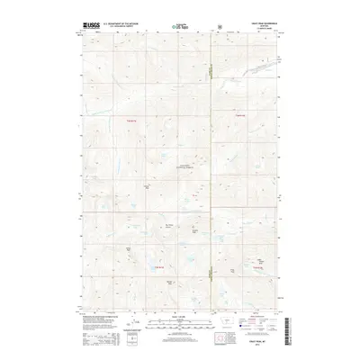
2014 Map of Crazy Peak
USGS Topo · Published 2014About this map
Gallatin National Forest encompasses this high-elevation terrain, where the watershed is defined by the headwaters of Sweet Grass Cr and Big Timber Cr. The landscape is dominated by a series of prominent summits, including the namesake Crazy Peak, as well as Granite Peak and Wilsall Peak. These peaks form a high-altitude divide between Park and Sweet Grass counties. The drainage patterns are intricate, with narrow canyons like Big Timber Canyon and high basins holding numerous alpine water bodies such as Diamond Lake, Rock Lake, and the Oasis Lakes. Of particular geological interest is the Grasshopper Glacier, situated near Conical Peak. The map illustrates a wilderness area where human infrastructure is largely absent, replaced by a complex network of creeks like Hell Roaring Cr and natural landmarks such as Thunder Rapids.
Find a feature on this map
49 named features on this map. Tap any name to fly to it.
Don’t see what you’re looking for? This feature index may not catch every label — zoom into the map to look around manually.
Map Details
Editions of this 2014 Crazy Peak Map
This is the sole edition of this map. No revisions or reprints were ever made.
Other maps of this area

1886 · Little Belt Mts.
USGS Topo · 1:250,000

1891 · Livingston
USGS Topo · 1:250,000

1893 · Livingston
USGS Topo · 1:250,000

1894 · Little Belt Mts.
USGS Topo · 1:250,000

1897 · Little Belt Mts.
USGS Topo · 1:250,000

1898 · Little Belt Mts.
USGS Topo · 1:250,000

1902 · Little Belt Mts.
USGS Topo · 1:250,000

1947 · Bozeman
USGS Topo · 1:250,000

1948 · Bozeman
USGS Topo · 1:250,000

1948 · White Sulphur Springs
USGS Topo · 1:250,000