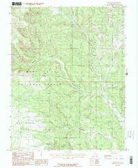
1985 Map of Cream Pots
USGS Topo · Published 1985About this map
Manti-La Sal National Forest dominates this mid-1980s landscape, characterized by the intricate drainage systems and high plateau points of San Juan County. The terrain is defined by deep incisions like Hammond Canyon and Posey Canyon, which channel into the prominent Cottonwood Creek corridor. While largely a wilderness area, the map preserves evidence of human activity through a single Corral and a Pack Trail that traverses the high ground near Milk Ranch Point. Geological and local naming conventions are evident in features such as the Cream Pots and the North Fork Whiskers Draw, suggesting a history of cattle ranching or early exploration. The presence of Gravel Pits near the washes indicates localized industrial extraction in an otherwise undeveloped territory where seasonal water flow at Dry Wash and Cottonwood Wash dictates the movement of people and livestock.
Find a feature on this map
17 named features on this map. Tap any name to fly to it.
Don’t see what you’re looking for? This feature index may not catch every label — zoom into the map to look around manually.
Map Details
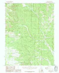
Editions of this 1985 Cream Pots Map
2 editions found
Other maps of this area

1886 · Abajo
USGS Topo · 1:250,000

1892 · Abajo
USGS Topo · 1:250,000

1893 · Abajo
USGS Topo · 1:250,000

1935 · Elk Ridge
USGS Topo · 1:96,000

1940 · Elk Ridge
USGS Topo · 1:125,000

1954 · Elk Ridge 4 NW
USGS Topo · 1:24,000

1954 · Elk Ridge 1 SW
USGS Topo · 1:24,000

1954 · Elk Ridge 2 SE
USGS Topo · 1:24,000

1954 · Elk Ridge 3 NE
USGS Topo · 1:24,000

1954 · Elk Ridge 1 SE
USGS Topo · 1:24,000