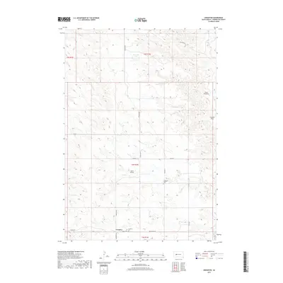
2017 Map of Creighton
USGS Topo · Published 2017About this map
Creighton sits at a crossroads of the South Dakota prairie, where a network of section-line roads like Babcock Rd and Creighton Rd facilitate movement across the rolling Pennington County landscape. This 2017 study reveals a community defined by its quiet institutions and the natural drainage patterns of the high plains. The local genealogy is anchored by the Creighton Cem near the town center and the Emmanuel Lutheran Cem to the northeast along 194th Ave.
Find a feature on this map
22 named features on this map. Tap any name to fly to it.
Don’t see what you’re looking for? This feature index may not catch every label — zoom into the map to look around manually.
Map Details
Editions of this 2017 Creighton Map
This is the sole edition of this map. No revisions or reprints were ever made.
Other maps of this area

1953 · Rapid City
USGS Topo · 1:250,000

1954 · Dalzell SE
USGS Topo · 1:24,000

1954 · Wasta NE
USGS Topo · 1:24,000

1954 · Dalzell NE
USGS Topo · 1:24,000

1955 · Pedro
USGS Topo · 1:24,000

1955 · Pedro NW
USGS Topo · 1:24,000

1955 · Creighton
USGS Topo · 1:24,000

1955 · Pedro SE
USGS Topo · 1:24,000

1957 · Rapid City
USGS Topo · 1:250,000
1983 · Horse Tooth
USGS Topo · 1:24,000