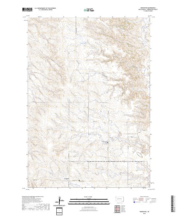
2023 Map of Creighton
USGS Topo · Published 2023About this map
The settlement of Creighton serves as the focal point for this section of Pennington County, situated at the intersection of Creighton Rd and Babcock Rd. This prairie landscape is defined by its drainage patterns, where the North Fork Rainy Creek flows through the southern reaches and the ephemeral waters of Deep Creek cut across the northeast. The terrain is marked by distinctive topographic depressions such as Seven D Draw, Three Tree Draw, and Fourmile Draw, which illustrate the erosion-carved character of the High Plains.
Find a feature on this map
22 named features on this map. Tap any name to fly to it.
Don’t see what you’re looking for? This feature index may not catch every label — zoom into the map to look around manually.
Map Details
Editions of this 2023 Creighton Map
This is the sole edition of this map. No revisions or reprints were ever made.
Other maps of this area

1953 · Rapid City
USGS Topo · 1:250,000

1954 · Dalzell SE
USGS Topo · 1:24,000

1954 · Wasta NE
USGS Topo · 1:24,000

1954 · Dalzell NE
USGS Topo · 1:24,000

1955 · Pedro
USGS Topo · 1:24,000

1955 · Pedro NW
USGS Topo · 1:24,000

1955 · Creighton
USGS Topo · 1:24,000

1955 · Pedro SE
USGS Topo · 1:24,000

1957 · Rapid City
USGS Topo · 1:250,000
1983 · Horse Tooth
USGS Topo · 1:24,000