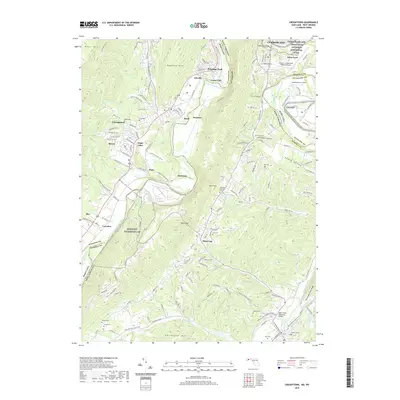
2019 Map of Cresaptown
USGS Topo · Published 2019About this map
The North Branch Potomac River serves as the winding boundary between Maryland and West Virginia, anchoring a landscape where rail and river history intersect. This area, just south of Cumberland, illustrates a complex 21st-century corridor of industry and aviation, featuring the Greater Cumberland Regional Airport and the specialized facilities of the Allegany Ballistics Lab. The legacy of 19th-century transport is preserved within the Chesapeake and Ohio Canal National Historical Park, which runs parallel to the modern CSX railroad lines that still navigate the river's tight bends through Welton Tunnel.
Find a feature on this map
161 named features on this map. Tap any name to fly to it.
Don’t see what you’re looking for? This feature index may not catch every label — zoom into the map to look around manually.
Map Details
Editions of this 2019 Cresaptown Map
This is the sole edition of this map. No revisions or reprints were ever made.
Other maps of this area

1891 · Romney
USGS Topo · 1:125,000

1898 · Frostburg
USGS Topo · 1:62,500

1899 · Flintstone
USGS Topo · 1:62,500

1900 · Flintstone
USGS Topo · 1:62,500

1901 · Frostburg
USGS Topo · 1:62,500

1908 · Frostburg
USGS Topo · 1:62,500

1920 · Keyser
USGS Topo · 1:62,500

1921 · Keyser
USGS Topo · 1:48,000

1921 · Hanging Rock
USGS Topo · 1:48,000

1922 · Keyser
USGS Topo · 1:62,500