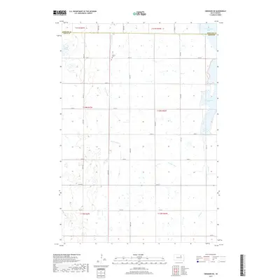
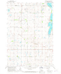
2017 Map of Cresbard NE
USGS Topo · Published 2017About this map
N Scatterwood Lake and S Scatterwood Lake define the eastern edge of this glaciated prairie landscape on the border of Edmunds and Faulk Counties. The terrain is characterized by numerous seasonal wetlands and basins, including the Tomek Slough and the winding course of Preachers Run, which meanders through the central sections. This rural expanse is organized by a precise grid of section lines and gravel roads, such as 367th Ave and 152nd St, reflecting the systematic agricultural development of the region. A significant site for local history is the United Cem, situated centrally near the headwaters of a local drainage. This survey provides a clear look at the drainage patterns and water bodies like Perry Cr that influenced early settlement and farmstead placement in this portion of South Dakota.
Find a feature on this map
30 named features on this map. Tap any name to fly to it.
Don’t see what you’re looking for? This feature index may not catch every label — zoom into the map to look around manually.
Map Details
Editions of this 2017 Cresbard NE Map
This is the sole edition of this map. No revisions or reprints were ever made.
Other maps of this area

1899 · Northville
USGS Topo · 1:125,000

1954 · Aberdeen
USGS Topo · 1:250,000

1956 · Aberdeen
USGS Topo · 1:250,000

1966 · Cresbard SE
USGS Topo · 1:24,000
1966 · Northville SW
USGS Topo · 1:24,000
1966 · Chelsea
USGS Topo · 1:24,000
1966 · Cresbard SW
USGS Topo · 1:24,000
1966 · Cresbard NE
USGS Topo · 1:24,000

1966 · Cresbard
USGS Topo · 1:24,000

1970 · Mina SW
USGS Topo · 1:24,000