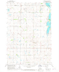
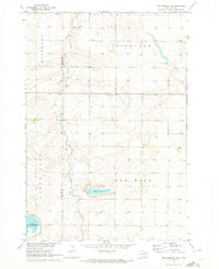
1966 Map of Cresbard NE
USGS Topo · Published 1967About this map
North Scatterwood Lake and South Scatterwood Lake dominate the eastern edge of this mid-1960s survey along the border of Edmunds and Faulk Counties. The landscape is a characteristic prairie mosaic of small wetlands and depressions, including Tomek Slough and various unnamed potholes that speak to the region's glacial history. Local infrastructure is defined by a rigid grid of section lines, though the presence of an Old Railroad Grade running east-to-west suggests an earlier era of rail-based transport that once bypassed the smaller townships like Union and Fairview.
Find a feature on this map
16 named features on this map. Tap any name to fly to it.
Don’t see what you’re looking for? This feature index may not catch every label — zoom into the map to look around manually.
Map Details
Editions of this 1966 Cresbard NE Map
This is the sole edition of this map. No revisions or reprints were ever made.
Other maps of this area

1899 · Northville
USGS Topo · 1:125,000

1954 · Aberdeen
USGS Topo · 1:250,000

1956 · Aberdeen
USGS Topo · 1:250,000

1966 · Cresbard SE
USGS Topo · 1:24,000
1966 · Northville SW
USGS Topo · 1:24,000
1966 · Chelsea
USGS Topo · 1:24,000
1966 · Cresbard SW
USGS Topo · 1:24,000

1966 · Cresbard
USGS Topo · 1:24,000

1970 · Mina SW
USGS Topo · 1:24,000
1970 · Lake Parmley SW
USGS Topo · 1:24,000