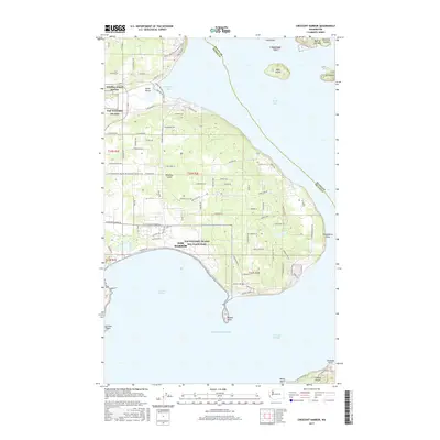
2017 Map of Crescent Harbor
USGS Topo · Published 2017About this map
NAS Whidbey Island and its associated NAS Whidbey Island Sea Plane Base dominate the northern and central portions of this coastal landscape on the eastern shore of Whidbey Island. This 2017 survey shows the modern footprint of these strategic military installations alongside the growing residential and commercial center of Oak Harbor. To the north, the Pacific NW National Scenic Trail winds through the varied terrain of Clover Valley, providing a recreational contrast to the industrial and naval infrastructure nearby.
Find a feature on this map
102 named features on this map. Tap any name to fly to it.
Don’t see what you’re looking for? This feature index may not catch every label — zoom into the map to look around manually.
Map Details
Editions of this 2017 Crescent Harbor Map
This is the sole edition of this map. No revisions or reprints were ever made.
Other maps of this area

1911 · Mount Vernon
USGS Topo · 1:125,000

1939 · Coupeville
USGS Topo · 1:62,500

1940 · Mt Vernon
USGS Topo · 1:62,500

1943 · Mt Vernon
USGS Topo · 1:62,500

1943 · Stanwood
USGS Topo · 1:62,500

1943 · Deception Pass
USGS Topo · 1:62,500

1951 · Deception Pass
USGS Topo · 1:62,500

1953 · Coupeville
USGS Topo · 1:24,000

1953 · Camano
USGS Topo · 1:24,000
1956 · Utsalady
USGS Topo · 1:24,000