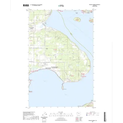
2020 Map of Crescent Harbor
USGS Topo · Published 2020About this map
Nas Whidbey Island and its associated Nas Whidbey Island Sea Plane Base dominate the northern and central sections of this Whidbey Island survey. The landscape transitions from the urbanized edges of Oak Harbor to the more open, wetland-studded interior of Whidbey Island. Significant coastal features define the eastern shoreline, including Strawberry Point and the protected waters of Dugualla Bay.
Find a feature on this map
51 named features on this map. Tap any name to fly to it.
Don’t see what you’re looking for? This feature index may not catch every label — zoom into the map to look around manually.
Map Details
Editions of this 2020 Crescent Harbor Map
This is the sole edition of this map. No revisions or reprints were ever made.
Other maps of this area

1911 · Mount Vernon
USGS Topo · 1:125,000

1939 · Coupeville
USGS Topo · 1:62,500

1940 · Mt Vernon
USGS Topo · 1:62,500

1943 · Mt Vernon
USGS Topo · 1:62,500

1943 · Stanwood
USGS Topo · 1:62,500

1943 · Deception Pass
USGS Topo · 1:62,500

1951 · Deception Pass
USGS Topo · 1:62,500

1953 · Coupeville
USGS Topo · 1:24,000

1953 · Camano
USGS Topo · 1:24,000
1956 · Utsalady
USGS Topo · 1:24,000