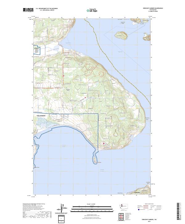
2023 Map of Crescent Harbor
USGS Topo · Published 2023About this map
Whidbey Island dominates this coastal survey, showcasing the eastern shoreline where it meets Skagit Bay and the Saratoga Passage. The topography reveals a landscape shaped by glacial deposits, characterized by the low-lying Clover Valley and numerous sheltered inlets. The eastern expansion of Oak Harbor is evident along the shores of Crescent Harbor, illustrating the relationship between the town's growth and its maritime geography.
Find a feature on this map
109 named features on this map. Tap any name to fly to it.
Don’t see what you’re looking for? This feature index may not catch every label — zoom into the map to look around manually.
Map Details
Editions of this 2023 Crescent Harbor Map
This is the sole edition of this map. No revisions or reprints were ever made.
Other maps of this area

1911 · Mount Vernon
USGS Topo · 1:125,000

1939 · Coupeville
USGS Topo · 1:62,500

1940 · Mt Vernon
USGS Topo · 1:62,500

1943 · Mt Vernon
USGS Topo · 1:62,500

1943 · Stanwood
USGS Topo · 1:62,500

1943 · Deception Pass
USGS Topo · 1:62,500

1951 · Deception Pass
USGS Topo · 1:62,500

1953 · Coupeville
USGS Topo · 1:24,000

1953 · Camano
USGS Topo · 1:24,000
1956 · Utsalady
USGS Topo · 1:24,000