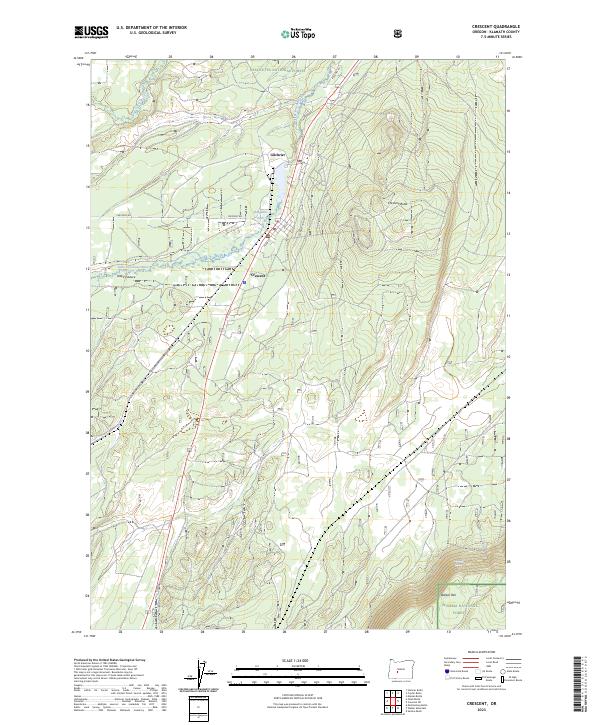
2023 Map of Crescent
USGS Topo · Published 2023About this map
Gilchrist and Crescent serve as the primary hubs for this region of Klamath County, situated along the timber and transport corridor of the Little Deschutes River. The landscape is defined by the transition between the Deschutes National Forest and the Winema National Forest, where the prominent Walker Rim and Crescent Butte rise above the basin. This area has long been centered on the forest industry, evidenced by the presence of the Gilchrist Haul Rd and the proximity of Bingham Park. The map also details the hydrology of the upper Deschutes drainage, including the winding course of Crescent Creek and the localized opening of Odell Pasture. These features provide a modern look at the settlement patterns and protected lands that have shaped this portion of Central Oregon.
Find a feature on this map
21 named features on this map. Tap any name to fly to it.
Don’t see what you’re looking for? This feature index may not catch every label — zoom into the map to look around manually.
Map Details
Editions of this 2023 Crescent Map
This is the sole edition of this map. No revisions or reprints were ever made.
Other maps of this area

1930 · Maiden Peak
USGS Topo · 1:125,000

1934 · Maiden Peak
USGS Topo · 1:125,000

1935 · Chemult
USGS Topo · 1:96,000

1941 · Chemult
USGS Topo · 1:125,000

1955 · Crescent
USGS Topo · 1:250,000

1957 · Crescent
USGS Topo · 1:250,000

1958 · Crescent
USGS Topo · 1:250,000

1963 · Hamner Butte
USGS Topo · 1:24,000

1963 · Masten Butte
USGS Topo · 1:24,000
1963 · Cryder Butte
USGS Topo · 1:24,000