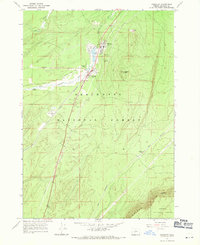
1967 Map of Crescent
USGS Topo · Published 1971About this map
Gilchrist and Crescent anchor this high-desert corridor where the timber and rail industries meet in the late 1960s. The Little Deschutes River meanders through the landscape, feeding into both Gilchrist Reservoir and Crescent Reservoir near the town sites. This region is a significant transportation hub, marked by the convergence of the Great Northern R. R. and the Klamath Northern railroad lines alongside the Crescent Airport.
Find a feature on this map
21 named features on this map. Tap any name to fly to it.
Don’t see what you’re looking for? This feature index may not catch every label — zoom into the map to look around manually.
Map Details
Editions of this 1967 Crescent Map
This is the sole edition of this map. No revisions or reprints were ever made.
Other maps of this area

1930 · Maiden Peak
USGS Topo · 1:125,000

1934 · Maiden Peak
USGS Topo · 1:125,000

1935 · Chemult
USGS Topo · 1:96,000

1941 · Chemult
USGS Topo · 1:125,000

1955 · Crescent
USGS Topo · 1:250,000

1957 · Crescent
USGS Topo · 1:250,000

1958 · Crescent
USGS Topo · 1:250,000

1963 · Hamner Butte
USGS Topo · 1:24,000

1963 · Masten Butte
USGS Topo · 1:24,000
1963 · Cryder Butte
USGS Topo · 1:24,000