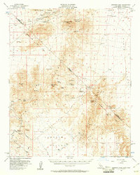
1956 Map of Crescent Peak
USGS Topo · Published 1961About this map
The Von Schmidt Line and the boundary between California and Nevada define this mid-century desert landscape, where mining operations and old transit routes intersect. Settled pockets like Vanderbilt and the Juan (Site) represent the human footprint in an area dominated by the Mc Cullough Range and New York Mountains. Significant local history is preserved through labels for ancient Petroglyphs and the proximity of a Cem near the site of Hart.
Find a feature on this map
43 named features on this map. Tap any name to fly to it.
Don’t see what you’re looking for? This feature index may not catch every label — zoom into the map to look around manually.
Map Details
Editions of this 1956 Crescent Peak Map
3 editions found
Other maps of this area

1886 · Camp Mohave
USGS Topo · 1:250,000

1892 · Camp Mohave
USGS Topo · 1:250,000

1910 · Ivanpah
USGS Topo · 1:250,000

1912 · Ivanpah
USGS Topo · 1:250,000

1926 · Nelson
USGS Topo · 1:96,000

1926 · Mohave City
USGS Topo · 1:96,000

1942 · Camp Mohave
USGS Topo · 1:250,000

1942 · Ivanpah
USGS Topo · 1:250,000

1947 · Kingman
USGS Topo · 1:250,000

1948 · Kingman
USGS Topo · 1:250,000