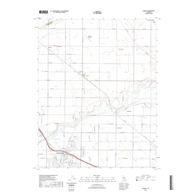
2018 Map of Cressey
USGS Topo · Published 2018About this map
The Merced River cuts through the heart of this agricultural landscape in the San Joaquin Valley, defining the development patterns of the northern Central Valley. The city of Livingston anchors the southwestern portion of the sheet, where an intricate network of irrigation infrastructure including the Livingston Canal, Arena Canal, and Hunter Lateral supports the region's intensive farming. To the north and east, the smaller rural communities of Cortez, Ballico, and Cressey sit among a grid of county roads and numerous named water features like the Ward Canal and Cressey Lateral. The map documents a sophisticated water management system essential to California's interior, visible in the dense web of drains and laterals such as the Jones Drain and King Lateral that crisscross the valley floor between the river and the Winton Cem at the eastern edge.
Find a feature on this map
110 named features on this map. Tap any name to fly to it.
Don’t see what you’re looking for? This feature index may not catch every label — zoom into the map to look around manually.
Map Details
Editions of this 2018 Cressey Map
This is the sole edition of this map. No revisions or reprints were ever made.
Other maps of this area

1913 · Dickenson
USGS Topo · 1:31,680

1916 · Three Tree Flat
USGS Topo · 1:31,680

1916 · Cressey
USGS Topo · 1:31,680

1916 · Montpellier
USGS Topo · 1:31,680

1916 · Denair
USGS Topo · 1:31,680

1917 · Turlock
USGS Topo · 1:31,680

1917 · Winton
USGS Topo · 1:31,680

1918 · Arena
USGS Topo · 1:31,680

1918 · Atwater
USGS Topo · 1:31,680

1918 · Stevinson
USGS Topo · 1:31,680