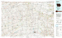
1993 Map of Creston
USGS Topo · Published 1993About this map
Creston and Greenfield anchor this southwestern Iowa landscape, captured in the early 1990s through revisions based on 1970s and 80s topographic surveys. The region is defined by its deep agricultural grid and the complex drainage of the East Nishnabotna River, Middle River, and Nodaway River. The map details a significant era of water management and recreation, highlighting Green Valley State Park and the large expanse of Lake Icaria County Recreation Area.
Find a feature on this map
80 named features on this map. Tap any name to fly to it.
Don’t see what you’re looking for? This feature index may not catch every label — zoom into the map to look around manually.
Map Details
Editions of this 1993 Creston Map
This is the sole edition of this map. No revisions or reprints were ever made.
Other maps of this area

1908 · Waukee
USGS Topo · 1:62,500

1949 · Adel
USGS Topo · 1:62,500

1951 · Adel
USGS Topo · 1:62,500

1951 · Osceola
USGS Topo · 1:62,500

1951 · St. Charles
USGS Topo · 1:62,500

1951 · Afton
USGS Topo · 1:62,500

1952 · Panora
USGS Topo · 1:62,500

1952 · Winterset
USGS Topo · 1:62,500

1954 · Greenfield
USGS Topo · 1:62,500

1954 · Centerville
USGS Topo · 1:250,000