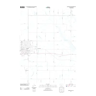
2013 Map of Creston East
USGS Topo · Published 2013About this map
Creston occupies the western edge of this 2013 survey, where a dense grid of residential streets gives way to the open agricultural lands of Union County. The eastern expansion of the city is marked by East Creston, situated along the primary arterial corridors. Local recreation and infrastructure are central to the landscape, including the Sears Sports Complex within the city and the Creston Municipal Airport to the south.
Find a feature on this map
74 named features on this map. Tap any name to fly to it.
Don’t see what you’re looking for? This feature index may not catch every label — zoom into the map to look around manually.
Map Details
Editions of this 2013 Creston East Map
This is the sole edition of this map. No revisions or reprints were ever made.
Other maps of this area

1951 · Afton
USGS Topo · 1:62,500

1954 · Omaha
USGS Topo · 1:250,000

1955 · Nebraska City
USGS Topo · 1:250,000

1957 · Nebraska City
USGS Topo · 1:250,000

1957 · Omaha
USGS Topo · 1:250,000

1958 · Omaha
USGS Topo · 1:250,000

1958 · Nebraska City
USGS Topo · 1:250,000

1980 · Creston East
USGS Topo · 1:24,000

1981 · Zion
USGS Topo · 1:24,000
1981 · Orient
USGS Topo · 1:24,000