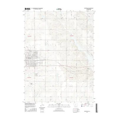
2015 Map of Creston East
USGS Topo · Published 2015About this map
Creston anchors the western edge of this Union County landscape, where the town's street grid meets the agricultural reaches of central Iowa. The area is defined by the branching waters of the Middle Platte River and its tributaries, including Twelvemile Cr and Three Mile Cr, which carve through the terrain as they flow toward the Grand River in the southeast. Several historic burial grounds, including Jerusalem Cem and Evergreen Cem in the north, and Graceland Cem to the south, provide important touchstones for local genealogical research. The presence of the County Home Cem near the eastern boundary offers a specific look into the county's social history. To the south of the main settlement, the Creston Municipal Airport occupies a flat expanse, while a dense network of numbered county roads like Co Rd P33 and Co Rd H33 connects the various townships and rural properties.
Find a feature on this map
100 named features on this map. Tap any name to fly to it.
Don’t see what you’re looking for? This feature index may not catch every label — zoom into the map to look around manually.
Map Details
Editions of this 2015 Creston East Map
This is the sole edition of this map. No revisions or reprints were ever made.
Other maps of this area

1951 · Afton
USGS Topo · 1:62,500

1954 · Omaha
USGS Topo · 1:250,000

1955 · Nebraska City
USGS Topo · 1:250,000

1957 · Nebraska City
USGS Topo · 1:250,000

1957 · Omaha
USGS Topo · 1:250,000

1958 · Omaha
USGS Topo · 1:250,000

1958 · Nebraska City
USGS Topo · 1:250,000

1980 · Creston East
USGS Topo · 1:24,000

1981 · Zion
USGS Topo · 1:24,000
1981 · Orient
USGS Topo · 1:24,000