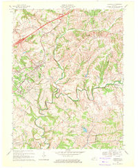
1969 Map of Crestwood
USGS Topo · Published 1971About this map
Pewee Valley and Crestwood serve as the primary hubs of activity in this 1969 revision, where the Louisville & Nashville railroad corridor dictates the placement of early settlements. The landscape is defined by the winding course of Floyds Fork and its various branches, creating a complex series of ridges and valleys across the junction of Oldham, Shelby, and Jefferson Counties.
Find a feature on this map
61 named features on this map. Tap any name to fly to it.
Don’t see what you’re looking for? This feature index may not catch every label — zoom into the map to look around manually.
Map Details
Editions of this 1969 Crestwood Map
This is the sole edition of this map. No revisions or reprints were ever made.
Other maps of this area

1905 · Prospect
USGS Topo · 1:62,500

1907 · Louisville
USGS Topo · 1:62,500

1912 · Prospect
USGS Topo · 1:62,500

1929 · Taylorsville
USGS Topo · 1:62,500

1932 · La Grange
USGS Topo · 1:62,500

1938 · Owen
USGS Topo · 1:24,000

1948 · Owen
USGS Topo · 1:24,000

1951 · Anchorage
USGS Topo · 1:24,000

1951 · Crestwood
USGS Topo · 1:24,000

1951 · Jeffersontown
USGS Topo · 1:24,000