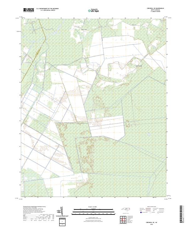
2022 Map of Creswell SE
USGS Topo · Published 2022About this map
The Scuppernong River meanders through this portion of the Inner Banks, where the landscape is defined by an extensive network of drainage infrastructure and low-lying wetlands. The small settlement of New Lands sits amidst a grid of rural roads and canals, illustrating the long history of land reclamation and timber management in this corner of the Coastal Plain. The map documents significant hydrologic features like the Thirty-foot Canal, Old Canal, and Bee Tree Canal, which were engineered to manage water levels across the surrounding reaches of the Hollow Ground Swamp.
Find a feature on this map
24 named features on this map. Tap any name to fly to it.
Don’t see what you’re looking for? This feature index may not catch every label — zoom into the map to look around manually.
Map Details
Editions of this 2022 Creswell SE Map
This is the sole edition of this map. No revisions or reprints were ever made.
Other maps of this area

1943 · Columbia
USGS Topo · 1:125,000

1953 · Columbia East
USGS Topo · 1:24,000

1953 · Scotia
USGS Topo · 1:24,000

1953 · Columbia West
USGS Topo · 1:24,000

1953 · Fairfield NW
USGS Topo · 1:24,000

1953 · Rocky Mount
USGS Topo · 1:250,000

1954 · Rocky Mount
USGS Topo · 1:250,000
1954 · Creswell
USGS Topo · 1:24,000
1954 · Creswell SE
USGS Topo · 1:24,000
1954 · New Lake
USGS Topo · 1:24,000