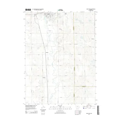
2014 Map of Crete South
USGS Topo · Published 2014About this map
Crete serves as the primary hub of this eastern Nebraska landscape, situated along the banks of the Big Blue River. The presence of Doane Coll near the northern edge of the map highlights the area's long-standing educational heritage, while the Crete Municipal Airport and a grid of rural routes like Co Road GGG and W Panama Rd illustrate the local transportation infrastructure. To the south and east, the settlements of Shestak and Kramer anchor small farming communities near the Saline and Lancaster County line. The terrain is marked by numerous water management projects, including Salt Cr Reservoir 27-C and Teal Reservoir, designed to control drainage into the river system. Genealogists will find significant value in the documentation of several local burial sites, such as the Bohemian National Cem, Blue Valley Cem, and the Sacred Heart Cem.
Find a feature on this map
56 named features on this map. Tap any name to fly to it.
Don’t see what you’re looking for? This feature index may not catch every label — zoom into the map to look around manually.
Map Details
Editions of this 2014 Crete South Map
This is the sole edition of this map. No revisions or reprints were ever made.
Other maps of this area

1897 · Lincoln
USGS Topo · 1:125,000

1935 · Dorchester
USGS Topo · 1:48,000

1940 · Dorchester
USGS Topo · 1:62,500

1955 · Lincoln
USGS Topo · 1:250,000

1957 · Lincoln
USGS Topo · 1:250,000

1957 · Clatonia
USGS Topo · 1:24,000

1957 · Wilber
USGS Topo · 1:24,000

1958 · Lincoln
USGS Topo · 1:250,000
1961 · Swanton
USGS Topo · 1:24,000
1964 · Pleasant Hill
USGS Topo · 1:24,000