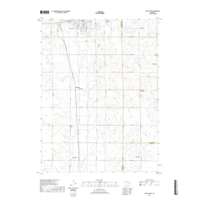
2017 Map of Crete South
USGS Topo · Published 2017About this map
Crete occupies the northern edge of this landscape, where the campus of Doane College and the Crete Municipal Airport sit near the winding course of the Big Blue River. This region of Saline County is characterized by a dense grid of rural roads and scattered agricultural settlements that speak to the area's Czech and central European heritage, most notably evidenced by the Bohemian National Cem and Sacred Heart Cem.
Find a feature on this map
57 named features on this map. Tap any name to fly to it.
Don’t see what you’re looking for? This feature index may not catch every label — zoom into the map to look around manually.
Map Details
Editions of this 2017 Crete South Map
This is the sole edition of this map. No revisions or reprints were ever made.
Other maps of this area

1897 · Lincoln
USGS Topo · 1:125,000

1935 · Dorchester
USGS Topo · 1:48,000

1940 · Dorchester
USGS Topo · 1:62,500

1955 · Lincoln
USGS Topo · 1:250,000

1957 · Lincoln
USGS Topo · 1:250,000

1957 · Clatonia
USGS Topo · 1:24,000

1957 · Wilber
USGS Topo · 1:24,000

1958 · Lincoln
USGS Topo · 1:250,000
1961 · Swanton
USGS Topo · 1:24,000
1964 · Pleasant Hill
USGS Topo · 1:24,000