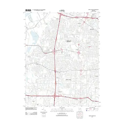
2012 Map of Creve Coeur
USGS Topo · Published 2012About this map
Creve Coeur Lake and its surrounding wetlands form a central geographical focus in this suburban landscape west of St. Louis. The area is defined by a dense network of residential developments and municipal boundaries that have matured around early settlements like Vigus and Pattonville. The presence of large-scale infrastructure, including the Lambert-Saint Louis International Airport in the northeast and the Creve Coeur Airport near the Missouri River, underscores the region's role as a major transportation hub.
Find a feature on this map
184 named features on this map. Tap any name to fly to it.
Don’t see what you’re looking for? This feature index may not catch every label — zoom into the map to look around manually.
Map Details
Editions of this 2012 Creve Coeur Map
This is the sole edition of this map. No revisions or reprints were ever made.
Other maps of this area

1903 · O'Fallon
USGS Topo · 1:125,000

1924 · Robertson
USGS Topo · 1:24,000

1927 · St. Charles
USGS Topo · 1:62,500

1931 · Manchester SE
USGS Topo · 1:24,000

1931 · Brussels
USGS Topo · 1:62,500

1932 · Manchester NE
USGS Topo · 1:24,000

1933 · Creve Coeur
USGS Topo · 1:24,000

1933 · Jefferson Barracks
USGS Topo · 1:24,000

1933 · Clayton
USGS Topo · 1:24,000

1933 · Saint Charles
USGS Topo · 1:62,500