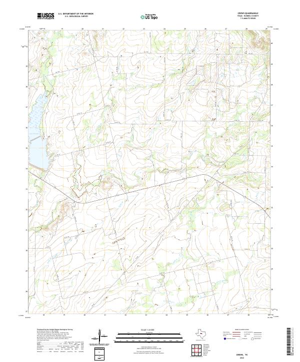
2022 Map of Crews
USGS Topo · Published 2022About this map
Lake Winters anchors the western edge of this West Texas landscape, where the drainage patterns of the Colorado River basin shape the local geography. A dense network of ranch-to-market roads, including FM 1770 and FM 382, provides the primary infrastructure through these plains in northeastern Runnels County. The terrain is defined by a series of intermittent waterways such as Gap Cr and Eagle Br, which converge toward the southeast. The intricate grid of county roads, such as Co RD 195 and Co RD 154, reflects a rural settlement pattern where large landholdings are accessed by a secondary transportation web. Local hydrologic features like S Fork Mud Cr and Mud Cr illustrate the subtle elevation changes characteristic of the region, providing vital landmarks for land surveys and genealogists tracing rural property lines.
Find a feature on this map
38 named features on this map. Tap any name to fly to it.
Don’t see what you’re looking for? This feature index may not catch every label — zoom into the map to look around manually.
Map Details
Editions of this 2022 Crews Map
This is the sole edition of this map. No revisions or reprints were ever made.
Other maps of this area

1890 · Abilene
USGS Topo · 1:125,000

1892 · Abilene
USGS Topo · 1:125,000

1892 · Ballinger
USGS Topo · 1:125,000

1921 · Hatchel
USGS Topo · 1:31,680

1954 · Brownwood
USGS Topo · 1:250,000

1954 · Abilene
USGS Topo · 1:250,000

1958 · Abilene
USGS Topo · 1:250,000
1967 · Hatchel
USGS Topo · 1:24,000

1967 · Talpa
USGS Topo · 1:24,000

1967 · Novice West
USGS Topo · 1:24,000