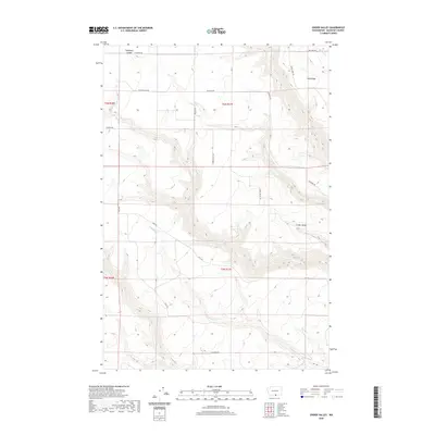
2020 Map of Crider Valley
USGS Topo · Published 2020About this map
Crider Valley defines the topography of this Klickitat County landscape, where the drainage of Alder Cr and Sixprong Cr carves through the basalt-edged plateau. The area is marked by significant elevation changes, particularly at Stegeman Canyon and the prominent Sand Ridge to the northeast. Settlement patterns follow the natural contours of the land, with a network of rural routes such as Crider Valley Rd, Stegeman Rd, and Van Horn Rd connecting dispersed ranchlands or farms. These roads often trace the higher ground between the canyon breaks. The map captures a high-desert environment characterized by seasonal watercourses like Pine Cr and Willow Cr, illustrating the relationship between the rugged Klickitat terrain and the infrastructure required to navigate this portion of Washington's interior.
Find a feature on this map
20 named features on this map. Tap any name to fly to it.
Don’t see what you’re looking for? This feature index may not catch every label — zoom into the map to look around manually.
Map Details
Editions of this 2020 Crider Valley Map
This is the sole edition of this map. No revisions or reprints were ever made.
Other maps of this area

1910 · Zillah
USGS Topo · 1:125,000

1916 · Arlington
USGS Topo · 1:125,000

1950 · Yakima
USGS Topo · 1:250,000

1953 · The Dalles
USGS Topo · 1:250,000

1956 · The Dalles
USGS Topo · 1:250,000

1957 · The Dalles
USGS Topo · 1:250,000

1958 · Yakima
USGS Topo · 1:250,000

1961 · Yakima
USGS Topo · 1:250,000
1962 · Douty Canyon
USGS Topo · 1:24,000

1962 · Heppner Junction
USGS Topo · 1:24,000