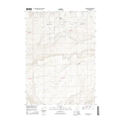
2015 Map of Crimson Dawn
USGS Topo · Published 2015About this map
Casper Mountain dominates the northern reaches of this Wyoming landscape, providing a high-altitude anchor for the surrounding Natrona County terrain. The survey details a network of residential and recreational roads winding through the forest, including Strube Loop and Tower Loop within Casper Mountain County Park. To the east, the eponymous Crimson Dawn area sits north of the high peaks, while the southern half of the map transitions into the more remote reaches of Muddy Mtn.
Find a feature on this map
60 named features on this map. Tap any name to fly to it.
Don’t see what you’re looking for? This feature index may not catch every label — zoom into the map to look around manually.
Map Details
Editions of this 2015 Crimson Dawn Map
This is the sole edition of this map. No revisions or reprints were ever made.
Other maps of this area

1949 · Brookhurst
USGS Topo · 1:24,000

1950 · Brookhurst
USGS Topo · 1:24,000

1950 · Goose Egg
USGS Topo · 1:24,000

1951 · Casper
USGS Topo · 1:24,000

1955 · Casper
USGS Topo · 1:250,000

1958 · Casper
USGS Topo · 1:250,000

1960 · Twin Buttes
USGS Topo · 1:24,000

1960 · Crimson Dawn
USGS Topo · 1:24,000

1960 · Sheep Creek
USGS Topo · 1:24,000

1960 · Ice Cave Mountain
USGS Topo · 1:24,000