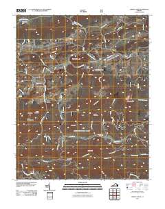
2011 Map of Cripple Creek
USGS Topo · Published 2011About this map
Noble Furnace, Eagle Furnace, and Raven Cliff Furnace stand as industrial landmarks along the waterway of Cripple Creek, reflecting the iron production history of this corner of Wythe County. The landscape is defined by its ridge-and-valley terrain, where small settlements like Shiloh, Henley, and Huddle are connected by a network of rural routes such as Mule Hell Rd and Farm Rd. To the south, the topography rises toward Ewing Mountain and Little Horse Heaven, with numerous drainages like Francis Mill Creek and Lick Creek carving through the hills. Genealogists may find interest in the centrally located Davis Cemetery or the community clusters at Cripple Creek town, while outdoor landmarks such as Raven Cliff Horse Camp and The Falls near Falls Branch highlight the area's natural features.
Find a feature on this map
57 named features on this map. Tap any name to fly to it.
Don’t see what you’re looking for? This feature index may not catch every label — zoom into the map to look around manually.
Map Details
Editions of this 2011 Cripple Creek Map
This is the sole edition of this map. No revisions or reprints were ever made.
Other maps of this area

1889 · Hillsville
USGS Topo · 1:125,000

1889 · Wytheville
USGS Topo · 1:125,000

1892 · Hillsville
USGS Topo · 1:125,000

1892 · Wytheville
USGS Topo · 1:125,000

1896 · Hillsville
USGS Topo · 1:125,000

1930 · Speedwell
USGS Topo · 1:62,500

1930 · Independence
USGS Topo · 1:48,000

1930 · Max Meadows
USGS Topo · 1:62,500

1931 · Galax
USGS Topo · 1:48,000

1933 · Independence
USGS Topo · 1:62,500