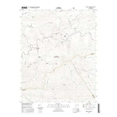
2016 Map of Cripple Creek
USGS Topo · Published 2016About this map
Eagle Furnace and Noble Furnace stand as industrial markers along the winding path of Cripple Creek, reflecting the iron-working heritage of Wythe County. The landscape is defined by the high ridges of the Jefferson National Forest, where features like Gleaves Knob, Hussy Mtn, and the curiously named Devils Den rise above the narrow valleys. Small settlements and crossroads such as Huddle, Shiloh, and Henley are connected by a network of rural routes, including Huddle Rd and Gleaves Rd.
Find a feature on this map
75 named features on this map. Tap any name to fly to it.
Don’t see what you’re looking for? This feature index may not catch every label — zoom into the map to look around manually.
Map Details
Editions of this 2016 Cripple Creek Map
This is the sole edition of this map. No revisions or reprints were ever made.
Other maps of this area

1889 · Hillsville
USGS Topo · 1:125,000

1889 · Wytheville
USGS Topo · 1:125,000

1892 · Hillsville
USGS Topo · 1:125,000

1892 · Wytheville
USGS Topo · 1:125,000

1896 · Hillsville
USGS Topo · 1:125,000

1930 · Speedwell
USGS Topo · 1:62,500

1930 · Independence
USGS Topo · 1:48,000

1930 · Max Meadows
USGS Topo · 1:62,500

1931 · Galax
USGS Topo · 1:48,000

1933 · Independence
USGS Topo · 1:62,500