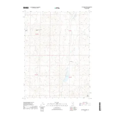
2018 Map of Crittenden Springs
USGS Topo · Published 2018About this map
Crittenden Springs and its nearby water infrastructure define this high-elevation landscape in northeastern Elko County. The area is anchored by the Crittenden Reservoir to the south and the Mill Cr Reservoir in the north, connected by a network of drainage systems including Crittenden Cr, Granite Cr, and Mill Cr. This drainage pattern highlights the importance of water management in a region flanked by the Delano Mountains on the west and the Goose Creek Mountains to the east.
Find a feature on this map
17 named features on this map. Tap any name to fly to it.
Don’t see what you’re looking for? This feature index may not catch every label — zoom into the map to look around manually.
Map Details
Editions of this 2018 Crittenden Springs Map
This is the sole edition of this map. No revisions or reprints were ever made.
Other maps of this area

1955 · Wells
USGS Topo · 1:250,000

1958 · Wells
USGS Topo · 1:250,000

1961 · Wells
USGS Topo · 1:250,000

1961 · Delano Mountains
USGS Topo · 1:62,500

1961 · Dairy Valley
USGS Topo · 1:62,500

1967 · Jackson Spring
USGS Topo · 1:24,000

1967 · Twelvemile Ranch
USGS Topo · 1:24,000

1967 · Ninemile Mtn NE
USGS Topo · 1:24,000
1980 · Dry Canyon
USGS Topo · 1:24,000
1981 · Wells
USGS Topo · 1:100,000