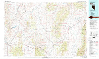
1981 Map of Wells
USGS Topo · Published 1981About this map
The high desert basins of northeast Nevada are defined here by a massive convergence of early western infrastructure where the Southern Pacific and Western Pacific railroads trace the natural corridors of the Goshute Valley and Tecoma Valley. The settlement at Wells serves as a critical junction, situated where the Snake Mountains meet the Wood Hills and providing a gateway to the livestock and mineral lands of the interior.
Find a feature on this map
59 named features on this map. Tap any name to fly to it.
Don’t see what you’re looking for? This feature index may not catch every label — zoom into the map to look around manually.
Map Details
Editions of this 1981 Wells Map
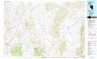
2 editions found
Other maps of this area

1935 · Halleck
USGS Topo · 1:125,000

1953 · Tooele
USGS Topo · 1:250,000

1954 · Brigham City
USGS Topo · 1:250,000

1955 · Tooele
USGS Topo · 1:250,000

1955 · Wells
USGS Topo · 1:250,000

1955 · Elko
USGS Topo · 1:250,000

1958 · Wells
USGS Topo · 1:250,000

1958 · Elko
USGS Topo · 1:250,000

1958 · Brigham City
USGS Topo · 1:250,000

1961 · Wells
USGS Topo · 1:250,000