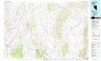
1981 Map of Wells
USGS Topo · Published 1981About this map
The high desert corridors of northeast Nevada are defined by the convergence of the Southern Pacific and Western Pacific railroads as they navigate the basin and range topography. Centered on the town of Wells, the landscape transitions from the Snake Mountains in the west to the Pilot Range on the Utah border. Key mountain passes such as Moor Summit and Pequop Summit illustrate the strategic transportation routes used by both rail and road to cross the rugged Pequop Mountains.
Find a feature on this map
77 named features on this map. Tap any name to fly to it.
Don’t see what you’re looking for? This feature index may not catch every label — zoom into the map to look around manually.
Map Details
Editions of this 1981 Wells Map
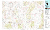
2 editions found
Other maps of this area

1935 · Halleck
USGS Topo · 1:125,000

1953 · Tooele
USGS Topo · 1:250,000

1954 · Brigham City
USGS Topo · 1:250,000

1955 · Tooele
USGS Topo · 1:250,000

1955 · Wells
USGS Topo · 1:250,000

1955 · Elko
USGS Topo · 1:250,000

1958 · Wells
USGS Topo · 1:250,000

1958 · Elko
USGS Topo · 1:250,000

1958 · Brigham City
USGS Topo · 1:250,000

1961 · Wells
USGS Topo · 1:250,000