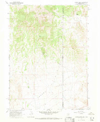
1967 Map of Jackson Spring
USGS Topo · Published 1971About this map
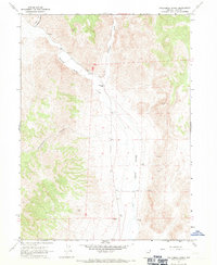
Jackson Mines stands as a focal point of industrial activity on the eastern slopes of the mountains, overlooking a landscape defined by scarce water sources and rugged transit. This 1967 field-checked survey reveals a network of primitive transportation, where a Jeep Trail and various unpaved routes provide the only access through the high desert terrain. The transition from the highlands down into the Tecoma Valley is marked by critical hydrologic features like Jackson Spring, Kilgore Spring, and a lonely Well in the valley floor, which were essential for both livestock and mining operations in this arid region.
Find a feature on this map
13 named features on this map. Tap any name to fly to it.
Don’t see what you’re looking for? This feature index may not catch every label — zoom into the map to look around manually.
Map Details
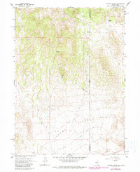
Editions of this 1967 Jackson Spring Map
2 editions found
Other maps of this area

1954 · Brigham City
USGS Topo · 1:250,000

1955 · Wells
USGS Topo · 1:250,000

1958 · Wells
USGS Topo · 1:250,000

1958 · Brigham City
USGS Topo · 1:250,000

1961 · Wells
USGS Topo · 1:250,000
1961 · Dairy Valley
USGS Topo · 1:62,500

1962 · Brigham City
USGS Topo · 1:250,000
1967 · Lucin
USGS Topo · 1:24,000
1967 · Twelvemile Ranch
USGS Topo · 1:24,000
1967 · Montello
USGS Topo · 1:24,000