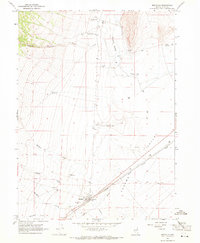
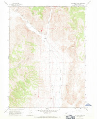
1967 Map of Montello
USGS Topo · Published 1971About this map
Montello serves as a critical rail siding and crossroads in this late 1960s survey of eastern Elko County. The Southern Pacific railroad cuts diagonally across the landscape, paralleled by a notable aqueduct and the wide Loray Wash. This corridor was essential for movement through the high desert, supported by localized infrastructure like the Montello Landing Field and various Borrow Pits that likely provided materials for rail and road maintenance. To the north, the Gamble Ranch and its associated Gamble Ranch Landing Strip indicate a landscape dominated by large-scale ranching operations. The terrain is defined by the drainage of Thousand Springs Creek and numerous smaller watercourses such as Charley Creek and Hoppie Creek that emerge from Gamble Canyon, illustrating the hydrological patterns of Tecoma Valley.
Find a feature on this map
26 named features on this map. Tap any name to fly to it.
Don’t see what you’re looking for? This feature index may not catch every label — zoom into the map to look around manually.
Map Details
Editions of this 1967 Montello Map
This is the sole edition of this map. No revisions or reprints were ever made.
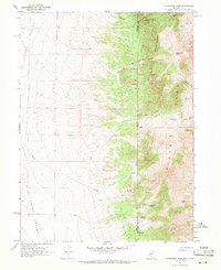
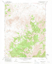
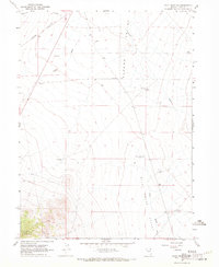
Other maps of this area

1955 · Wells
USGS Topo · 1:250,000

1958 · Wells
USGS Topo · 1:250,000

1961 · Wells
USGS Topo · 1:250,000
1967 · Jackson Spring
USGS Topo · 1:24,000
1967 · Loray
USGS Topo · 1:24,000
1967 · Montello Canyon
USGS Topo · 1:24,000
1967 · Twelvemile Ranch
USGS Topo · 1:24,000
1967 · Patterson Pass
USGS Topo · 1:24,000
1967 · Ninemile Mtn NE
USGS Topo · 1:24,000
1967 · Pilot Peak NW
USGS Topo · 1:24,000