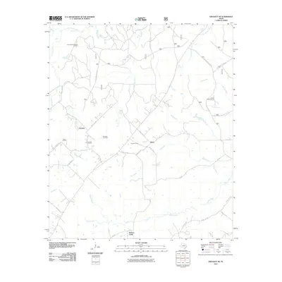
2010 Map of Crockett NE
USGS Topo · Published 2010About this map
The Edens-Madden Massacre Cemetery stands as a somber monument to local frontier history in this section of Houston County. Located near the northern boundary, it anchors a landscape defined by small rural settlements like Germany and Belott. The latter features the Belott Post Office, a rare specific structural label that indicates the community's role as a local crossroads.
Find a feature on this map
44 named features on this map. Tap any name to fly to it.
Don’t see what you’re looking for? This feature index may not catch every label — zoom into the map to look around manually.
Map Details
Editions of this 2010 Crockett NE Map
This is the sole edition of this map. No revisions or reprints were ever made.
Other maps of this area
1946 · Alto
USGS Topo · 1:62,500
1950 · Crockett
USGS Topo · 1:24,000
1950 · Crockett NE
USGS Topo · 1:24,000
1950 · Ratcliff
USGS Topo · 1:24,000
1951 · Crockett
USGS Topo · 1:24,000
1951 · Kennard
USGS Topo · 1:24,000
1951 · Grapeland
USGS Topo · 1:24,000
1951 · Berea
USGS Topo · 1:24,000
1951 · Crockett NE
USGS Topo · 1:24,000
1951 · Ratcliff
USGS Topo · 1:24,000