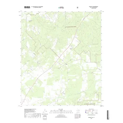
2019 Map of Crockett NE
USGS Topo · Published 2019About this map
Edens-Madden Massacre Cem stands as a notable historical marker near the headwaters of San Pedro Cr in this portion of Houston County. The landscape is defined by the dense woodlands of the Davy Crockett National Forest, where a network of rural routes like Co RD 1545 and FM 1733 connect isolated settlements and family burial grounds. The small community of Belott serves as a local crossroads, positioned between the drainage of Rosy Bayou and the higher ground of Holcomb Hill. Several smaller cemeteries, including Parker Cem and Grounds Cem, are scattered throughout the forest, offering significant data points for genealogists tracing family histories in the Piney Woods. The presence of the Last Resort Airport and scattered springs like Pine Spring illustrate the varied land use in this timber-rich region of East Texas.
Find a feature on this map
42 named features on this map. Tap any name to fly to it.
Don’t see what you’re looking for? This feature index may not catch every label — zoom into the map to look around manually.
Map Details
Editions of this 2019 Crockett NE Map
This is the sole edition of this map. No revisions or reprints were ever made.
Other maps of this area

1946 · Alto
USGS Topo · 1:62,500

1950 · Crockett
USGS Topo · 1:24,000

1950 · Crockett NE
USGS Topo · 1:24,000

1950 · Ratcliff
USGS Topo · 1:24,000

1951 · Crockett
USGS Topo · 1:24,000

1951 · Kennard
USGS Topo · 1:24,000

1951 · Grapeland
USGS Topo · 1:24,000

1951 · Berea
USGS Topo · 1:24,000

1951 · Crockett NE
USGS Topo · 1:24,000

1951 · Ratcliff
USGS Topo · 1:24,000