
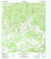
1950 Map of Crockett NE
USGS Topo · Published 1967About this map
Davy Crockett National Forest dominates the northern and eastern portions of this Houston County landscape, where the dense timber of East Texas meets the historic route of the Old Antonio Road. This 1950 survey documents a rural topography defined by small community hubs such as Belott and the Glover Sch. The drainage network is particularly dense here, featuring the headwaters of Rosy Bayou and the winding course of Hickory Creek. For those tracing local history, the map preserves the locations of several family and community landmarks, including Grounds Cem and Parker Cem, as well as the New Energy Ch and Pleasant Hill Ch. The arrangement of these churches and cemeteries along the unpaved roads illustrates the early 20th-century settlement patterns that persisted in the region before modern development changed the local landscape.
Find a feature on this map
20 named features on this map. Tap any name to fly to it.
Don’t see what you’re looking for? This feature index may not catch every label — zoom into the map to look around manually.
Map Details
Editions of this 1950 Crockett NE Map
2 editions found
Other maps of this area

1946 · Alto
USGS Topo · 1:62,500

1950 · Crockett
USGS Topo · 1:24,000

1950 · Ratcliff
USGS Topo · 1:24,000

1951 · Crockett
USGS Topo · 1:24,000

1951 · Kennard
USGS Topo · 1:24,000

1951 · Grapeland
USGS Topo · 1:24,000

1951 · Berea
USGS Topo · 1:24,000

1951 · Crockett NE
USGS Topo · 1:24,000

1951 · Ratcliff
USGS Topo · 1:24,000

1952 · Slocum
USGS Topo · 1:62,500