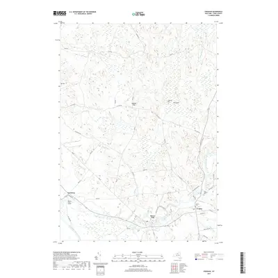
2019 Map of Croghan
USGS Topo · Published 2019About this map
The confluence of the Black River and the Beaver River anchors the southern portion of this Lewis County landscape, where the settlements of Croghan, Beaver Falls, and Naumburg are concentrated. The northern reaches transition into a terrain of low ridges and wetlands, punctuated by Mt Tom and the waters of Putman Swamp and the Indian River. This area is characterized by a dense network of local roads such as Old State Rd and Youngs Mill Rd, which connect small hamlets like Forest City. For those tracing local history, the map identifies several significant burial sites, including Salem Cem, Basselin Cem, and Saint Stephens Cem, providing essential coordinates for genealogical research. The drainage patterns of smaller tributaries like Swiss Cr and Widmeyer Cr reflect the historical importance of water power and irrigation in this rural New York region.
Find a feature on this map
50 named features on this map. Tap any name to fly to it.
Don’t see what you’re looking for? This feature index may not catch every label — zoom into the map to look around manually.
Map Details
Editions of this 2019 Croghan Map
This is the sole edition of this map. No revisions or reprints were ever made.
Other maps of this area

1902 · Carthage
USGS Topo · 1:62,500

1904 · Carthage
USGS Topo · 1:62,500

1911 · Antwerp
USGS Topo · 1:62,500

1911 · Lowville
USGS Topo · 1:62,500

1913 · Lowville
USGS Topo · 1:62,500

1913 · Lake Bonaparte
USGS Topo · 1:62,500

1916 · Lake Bonaparte
USGS Topo · 1:62,500

1943 · West Lowville
USGS Topo · 1:31,680

1943 · Carthage
USGS Topo · 1:31,680

1948 · Ogdensburg
USGS Topo · 1:250,000